# Flask Google Maps [](https://www.paypal.com/cgi-bin/webscr?cmd=_s-xclick&hosted_button_id=2UGZHBYZV39XY&source=url)
[](https://flaskextensions.com)
[](https://pypi.python.org/pypi/flask-googlemaps/)
[](https://pypi.org/project/flask-googlemaps/)
[](https://pypi.python.org/pypi/flask-googlemaps/)
[](https://pypi.python.org/pypi/flask-googlemaps/)
[](https://pypi.python.org/pypi/flask-googlemaps/)
[](https://github.com/flask-extensions/Flask-GoogleMaps/workflows/CI/badge.svg)
[](https://github.com/psf/black)
Easy to use Google Maps in your Flask application
## requires
- Jinja
- Flask
- A google api key [get here](https://developers.google.com/maps/documentation/javascript/get-api-key)
## Contribute
To contribute with the project, clone it, create a virtualenv and install all of you need to dev, see below:
```bash
git clone https://github.com/flask-extensions/Flask-GoogleMaps.git
cd Flask-GoogleMaps
poetry use env 3.8 # just to create virtualenv at the first time
poetry shell # activate virtualenv
poetry install # to install all for dev
```
## Installation
To use in your project just use your dependency manager to install it, with pip is like this:
```bash
pip install flask-googlemaps
```
## How it works
Flask-GoogleMaps includes some global functions and template filters in your Jinja environment, also it allows you to use the Map in views if needed.
### registering
in your app
```python
from flask import Flask
from flask_googlemaps import GoogleMaps
app = Flask(__name__)
# you can set key as config
app.config['GOOGLEMAPS_KEY'] = "8JZ7i18MjFuM35dJHq70n3Hx4"
# Initialize the extension
GoogleMaps(app)
# you can also pass the key here if you prefer
GoogleMaps(app, key="8JZ7i18MjFuM35dJHq70n3Hx4")
```
In template
```html
{{googlemap("my_awesome_map", lat=0.23234234, lng=-0.234234234, markers=[(0.12,
-0.45345), ...])}}
```
That's it! now you have some template filters and functions to use, more details in examples and screenshot below.
### Usage
- You can create the map in the view and then send to the template context
- you can use the template functions and filters directly
#### 1. View
```python
from flask import Flask, render_template
from flask_googlemaps import GoogleMaps
from flask_googlemaps import Map
app = Flask(__name__, template_folder=".")
GoogleMaps(app)
@app.route("/")
def mapview():
# creating a map in the view
mymap = Map(
identifier="view-side",
lat=37.4419,
lng=-122.1419,
markers=[(37.4419, -122.1419)]
)
sndmap = Map(
identifier="sndmap",
lat=37.4419,
lng=-122.1419,
markers=[
{
'icon': 'http://maps.google.com/mapfiles/ms/icons/green-dot.png',
'lat': 37.4419,
'lng': -122.1419,
'infobox': "<b>Hello World</b>"
},
{
'icon': 'http://maps.google.com/mapfiles/ms/icons/blue-dot.png',
'lat': 37.4300,
'lng': -122.1400,
'infobox': "<b>Hello World from other place</b>"
}
]
)
return render_template('example.html', mymap=mymap, sndmap=sndmap)
if __name__ == "__main__":
app.run(debug=True)
```
##### `Map()` Parameters
- **lat**: The latitude coordinate for centering the map.
- **lng**: The longitude coordinate for centering the map.
- **zoom**: The zoom level. Defaults to `13`.
- **maptype**: The map type - `ROADMAP`, `SATELLITE`, `HYBRID`, `TERRAIN`. Defaults to `ROADMAP`.
- **markers**: Markers array of tuples having (**lat**, **lng**, infobox, icon, label). Defaults to `None`.
- or **markers**: a list of dicts containing **lat**, **lng**, infobox, icon, label.
- or **markers**: Markers dictionary with icon urls as keys and markers array as values.
- **varname**: The instance variable name.
- **style**: A string containing CSS styles. Defaults to `"height:300px;width:300px;margin:0;"`.
- **identifier**: The CSS ID selector name.
- **cls**: The CSS Class selector name. Defaults to `"map"`.
- **language**: The map language. Defaults to `"en"`.
- **region**: The map region. Defaults to `"US"`.
Also controls True or False:
- zoom_control
- maptype_control
- scale_control
- scale_control
- streetview_control
- rotate_control
- fullscreen_control
- scroll_wheel
- collapsible (map collapses by click on **varname**\_collapse button)
- mapdisplay (show a collapsible map by default or not)
- center_on_user_location (using HTML5 Geolocation)
#### 2. Template
```html
<!DOCTYPE html>
<html>
<head>
{{"decoupled-map"|googlemap_js(37.4419, -122.1419, markers=[(37.4419,
-122.1419)])}} {{mymap.js}} {{sndmap.js}}
</head>
<body>
<h1>Flask Google Maps Example</h1>
<h2>Template function centered, no marker</h2>
{{googlemap("simple-map", 37.4419, -122.1419)}}
<h2>Template filter decoupled with single marker</h2>
{{"decoupled-map"|googlemap_html(37.4419, -122.1419)}}
<h2>Template function with multiple markers</h2>
{% with map=googlemap_obj("another-map", 37.4419, -122.1419,
markers=[(37.4419, -122.1419), (37.4300, -122.1400)]) %} {{map.html}}
{{map.js}} {% endwith %}
<h2>First map generated in view</h2>
{{mymap.html}}
<h2>Second map generated in view</h2>
<h3>Example for different icons in multiple markers with infoboxes</h3>
{{sndmap.html}}
</body>
</html>
```
### Infobox
Here's an example snippet of code:
```python
Map(
identifier="catsmap",
lat=37.4419,
lng=-122.1419,
markers=[
{
'icon': 'http://maps.google.com/mapfiles/ms/icons/green-dot.png',
'lat': 37.4419,
'lng': -122.1419,
'infobox': "<img src='cat1.jpg' />"
},
{
'icon': 'http://maps.google.com/mapfiles/ms/icons/blue-dot.png',
'lat': 37.4300,
'lng': -122.1400,
'infobox': "<img src='cat2.jpg' />"
},
{
'icon': 'http://maps.google.com/mapfiles/ms/icons/yellow-dot.png',
'lat': 37.4500,
'lng': -122.1350,
'infobox': "<img src='cat3.jpg' />"
}
]
)
```
Which results in something like the following map:
<img width="1439" alt="screen shot 2015-07-29 at 2 41 52 pm" src="https://cloud.githubusercontent.com/assets/8108300/8969650/13b0de7a-3602-11e5-9ed0-9f328ac9253f.png">
### Label
Here's an example snippet of code:
```python
Map(
identifier="labelsmap",
lat=37.4419,
lng=-122.1419,
markers=[
{
'lat': 37.4500,
'lng': -122.1350,
'label': "X"
},
{
'lat': 37.4419,
'lng': -122.1419,
'label': "Y"
},
{
'lat': 37.4300,
'lng': -122.1400,
'label': "Z"
}
]
)
```
Which results in something like the following map:
<img width="271" alt="Map showing markers with labels" src="https://user-images.githubusercontent.com/708882/92332217-a3363280-f041-11ea-975c-0ac9413ada68.png">
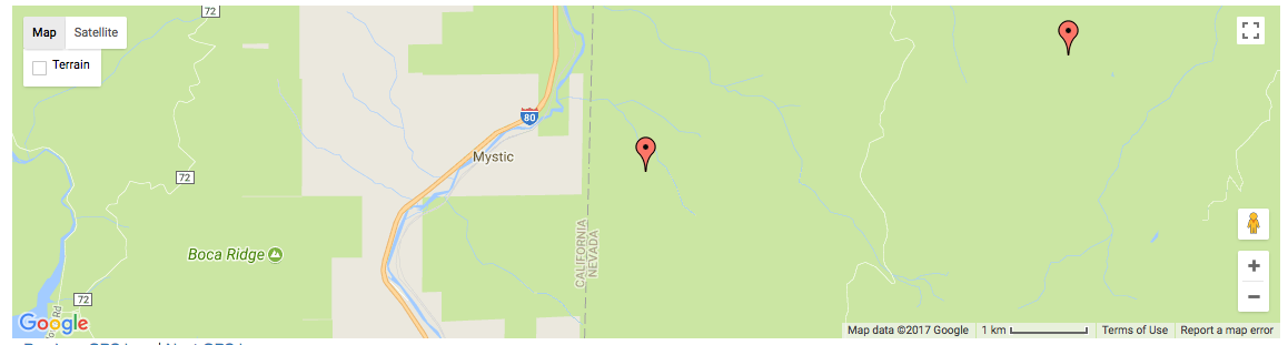
### Fit all markers within bounds
Allow users to easily fit all markers within view on page load
#### Without bounds
```python
@app.route('/map-unbounded/')
def map_unbounded():
"""Create map with markers out of bounds."""
locations = [] # long list of coordinates
map = Map(
lat=locations[0].latitude,
lng=locations[0].longitude,
markers=[(loc.latitude, loc.longitude) for loc in locations]
)
return render_template('map.html', map=map)
```
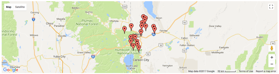
#### With bounds
```python
@app.route('/map-bounded/')
def map_bounded():
"""Create map with all markers within bounds."""
locations = [] # long list of coordinates
map = Map(
lat=locations[0].latitude,
lng=locations[0].longitude,
markers=[(loc.latitude, loc.longitude) for loc in locations],
fit_markers_to_bounds = True
)
return render_template('map.html', map=map)
```
### Geocoding and Reverse Geocoding
```python
from flask_googlemaps import get_address, get_coordinates
API_KEY = 'YOUR API KEY'
#Reverse Geocoding: getting detailed address from coordinates of a location
print(get_address(API_KEY,22.4761596,88.4149326))
#output: {'zip': '700150', 'country': 'India', 'state': 'West Bengal', 'city': 'Kolkata', 'locality': 'Kolkata', 'road': 'Techno City', 'formatted_address': 'Sirin Rd, Mauza Ranabhutia, Techno City, Kolkata, West Bengal 700150, India'}
#Geocoding: getting coordinates from address text
print(get_coordinates(API_KEY,'Netaji Subhash Engineering College Kolkata'))
#output: {'lat': 22.4761596, 'lng': 88.4149326}
```
### Run the example app
```bash
$ git clone https://github.com/flask-extensions/Flask-GoogleMaps
$ cd Flask-GoogleMaps/
```
If you have Poetry
```bash
$ poetry install
```
without poetry
```bash
$ pip install --upgrade pip
$ pip install -e .
$ pip install -r requirements.txt
```
Run it.
```bash
$ FLASK_GOOGLEMAPS_KEY="YourKeyHERE" FLASK_APP=examples/example.py flask run
running on localhost:5000 .....
```
Access: http://localhost:5000/ and http://localhost:5000/fullmap
## Contribute with the Google Maps API
Please see this page [developers.google.com/maps/documentation/javascript/tutorial](https://developers.google.com/maps/documentation/javascript/tutorial) and contribute!


